

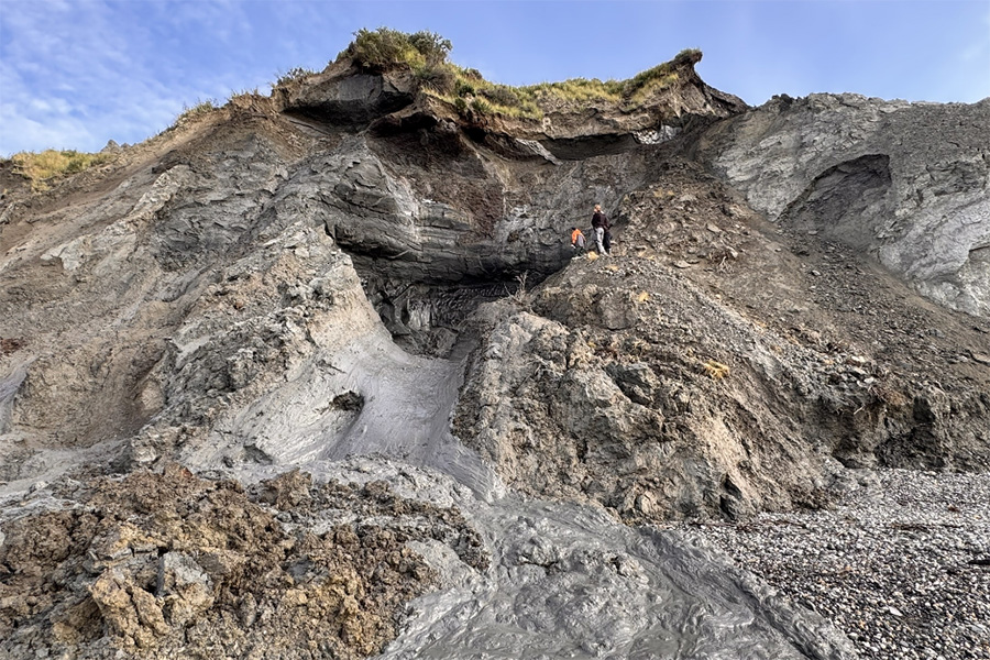
Headwall of a thaw slump along the Miner River, 85 km southeast of Tuktoyaktuk, NWT, Canada. Credits: Carolina Voigt, AWI (2025).
News: Summer Field Work Concluded from Interior Alaska to the Arctic Coast
Active permafrost exposure and thaw slump inspected by the team on the Baldwin Peninsula in West Alaska (Photo by G. Grosse)
Fieldwork in Interior Alaska began as early as June. Based in Fairbanks,  teams led by Katey Walter Anthony from the University of Alaska Fairbanks (UAF) conducted greenhouse gas surveys using flux chambers and sampled soil gas across a variety of permafrost thaw-affected landscapes, including thermoerosional gullies, thermokarst mound uplands, lakes and lake margins. Using probes and drills, the researchers measured active layer and talik depths, as well as ground temperatures.
Additional ground temperature data were collected along a transect of long-term monitoring sites along the Dalton Highway. New monitoring locations were established in areas of rapidly degrading permafrost, including gullies, drained lake basins, pond margins and water tracks. Aerial drone surveys complemented this fieldwork, led by Vladimir Romanovsky and Dmitry Nicolsky from UAF. In July and August, field visits and measurements of ground temperatures and greenhouse gas fluxes extended westward along the road from Nome to Kougarok.
At the same time, an AWI team joined UAF colleagues in western Alaska, where Guido Grosse, Carl Stadie, Anne Morgenstern, Friedrich Röseler and Sarah Schmickal first conducted drone and geodetic surveys as well as soil studies and permafrost coring near Unalakleet, and then continued around Kotzebue on the Baldwin Peninsula. They collected over 70 driftwood samples and about 300 kg of permafrost samples from exposures, cores and soil profiles along several transects spanning different thaw features, including drained lake basins, gullies, and thermokarst mounds. Field investigations were complemented by ground temperature, talik, and active layer depth measurements, as well as hydrochemical sampling of surface waters in thermokarst ponds, gullies and streams.
Further field sites were established at long-term monitoring locations in Utqiaġvik on the Alaskan Coastal Plain. Dmitry Nicolsky from UAF set up new sites in low-centered and high-centered polygonal tundra, where greenhouse gas fluxes and eddy covariance measurements will help researchers investigate carbon exchange in these Arctic landscapes.
As autumn arrived in Interior Alaska, UAF teams wrapped up their fieldwork near Fairbanks. The final activities included collecting permafrost cores from gullies and lake margins, sampling gas from talik wells and measuring greenhouse gas fluxes. All in all, around thousands of flux measurements were taken in Alaska, with new planned field observations of fluxes and gas seepage from ice-covered thermokarst lakes just around the corner during the freeze-up period.
JL